FarmingIT offer a range of topographic mapping services, tailored to your specific needs. Using the most accurate survey grade, dual-frequency RTK GPS system, we are able to maintain centimetre accuracy. Unlike traditional surveying techniques we are able to do this without the need for line-of-sight access to our base station. This make working over large properties, around hills, and behind trees and buildings much more efficient. |
|
Making use of the AUSPOS service from Geoscience Australia, we are able to provide our map data corrected to GDA94, if specifically required, without the need to pick up a survey mark on the property. Our clients are provided with hard copy maps, which we can print and laminate in-house up to A1 size (594mm X 841mm). We also supply all map data in digital form on a CD or DVD in the end users choice of file format and projection.
|
|
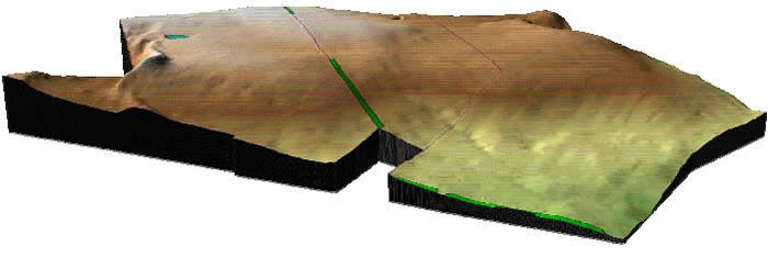
We archive all customer data to provide reprints of maps in the future if required. As well as traditional contour maps (above image) we are also able to create 3D surface images like the one below, and model areas of watersheds and volumes of runoff. |
|
 |
|
|
You need to upgrade your Flash Player, or turn on JavaScript in your browser.
 |
||
|
||
 |
||
