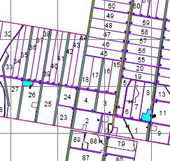
If you can see it (or know where it is) FarmingIT can map it for you! From whole farm asset maps, to just recording the location of a new power cable, water pipe or ag drainage line, we are able to record it quickly and easily, with centimetre accuracy. We can even come back in the future to locate previously mapped buried services. |
||
Making use of the AUSPOS service from Geoscience Australia, we are able to provide our map data corrected to GDA94, if specifically required, without the need to pick up a survey mark on the property. Our clients are provided with hard copy maps, which we can print and laminate in-house up to A1 size (594mm X 841mm). We also supply all map data in digital form on a CD or DVD in the end users choice of file format and projection. |
 |
|
| We archive all customer data to provide reprints of maps in the future if required. | ||
|
You need to upgrade your Flash Player, or turn on JavaScript in your browser.
 |
||
|
||
 |
||