Rapid and precise data collection
MEASURE - MONITOR - MANAGE
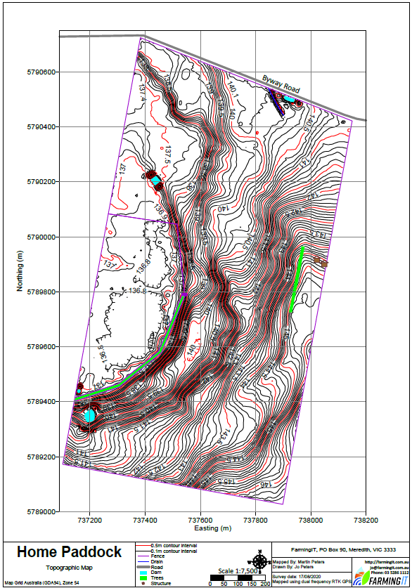
Farm Map
- Accurate paddock area
- Croppable area vs fenced area
- Paddock features
- water troughs
- gates
- trees
- poles
Topographic
- Data collected with survey grade GNSS equipment (GPS & GLONAS)
- Levels of culverts and spillways recorded to aid drainage design
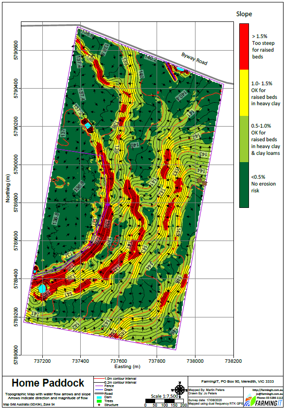
Interpretation
- Hydrology maps
- Watershed calculations
- Slope and aspect modelling
- Natural stream and water flow modelling